Many people are unaware that our counties remain exactly as they always have been since being established in the Anglo-Saxon era. Often signs which mark the territories of local authority areas are misinterpreted as indicating county boundaries. However, signs marking the boundaries of our true counties, points where three or more counties meet and others which proclaim county identity can be found across the country.
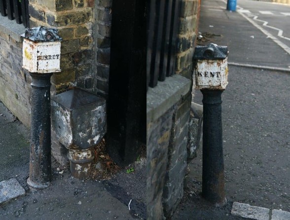
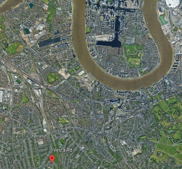
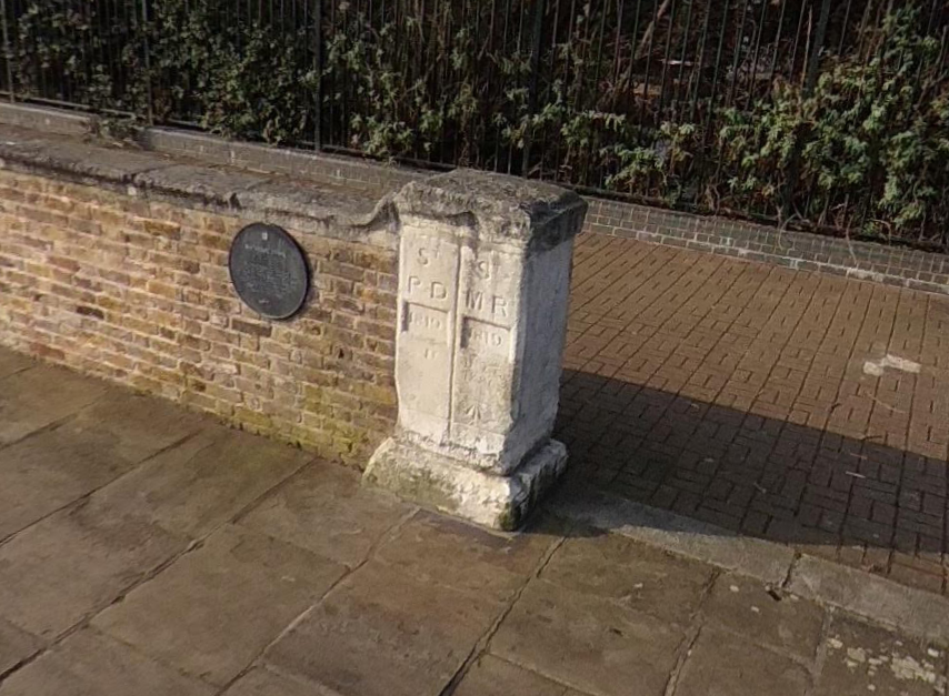
The Kent / Surrey border post seen above from each side, is located on Vesta Rd near New Cross Gate.
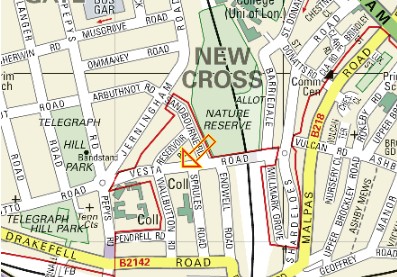
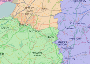
It is a great example of a county boundary marker, in an urban area. The county boundary continues a short distance north, as indicated on the section below, taken from the county map hosted by Wikishire with Kent in purple and Surrey in green.
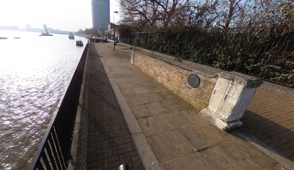
to the Thames path, on the south side of the river, where this stone sign
indicates a parish boundary, which is the same as the county border.
An 1841 print depicting the Kent–Surrey border just south of Surrey Commercial Docks

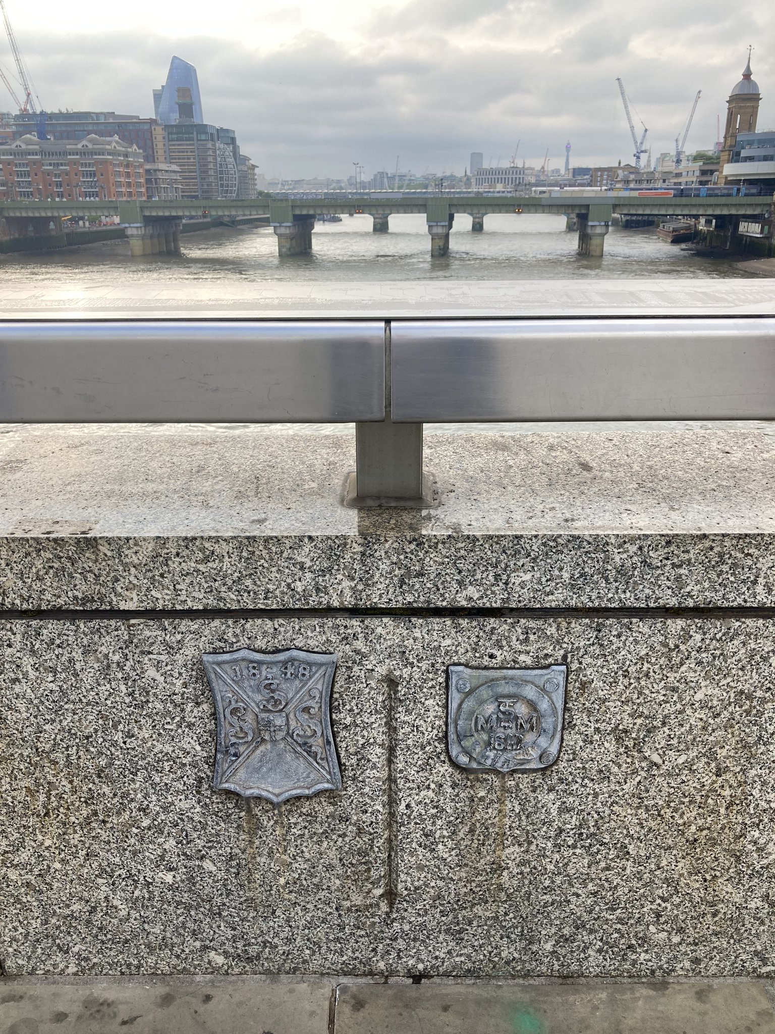
Surrey and Middlesex meet at a point on London Bridge, indicated by these boundary signs of Saint Saviour Parish, to the south, left in the pictures and Saint Magnus The Martyr, to the north, right in the photos, which come from Beating The Bounds (@Ldn_Boundaries).
Two signs are displayed at St Luke’s Church,

just off Old Street , EC1

and Whitecross Street, just a little south

denoting the Middlesex identity of these locations. Pictures from Josephine Gardiner.
A fine print of the second famous Bridge at Bow which crosses the River Lea, the historic boundary between Middlesex and Essex.
 The entrance to Cromwell House Antiques Centre, in Battlesbridge, Essex, is flanked by two low columns, constructed in 1860,

which proudly bear the county’s famed three seaxes
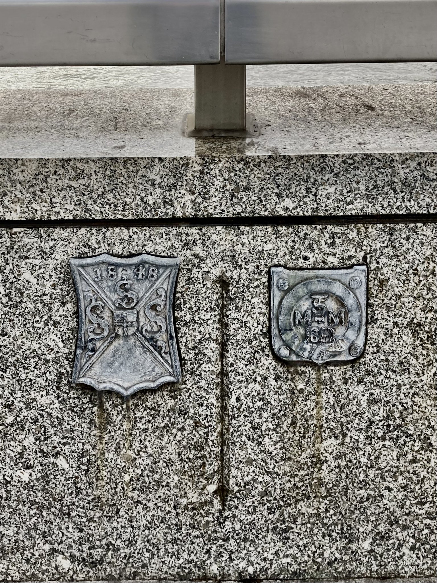
On the Surrey road, heading west, out of Bournemouth
towards the Dorset village of Branksome,

this splendid brick column
marks the border
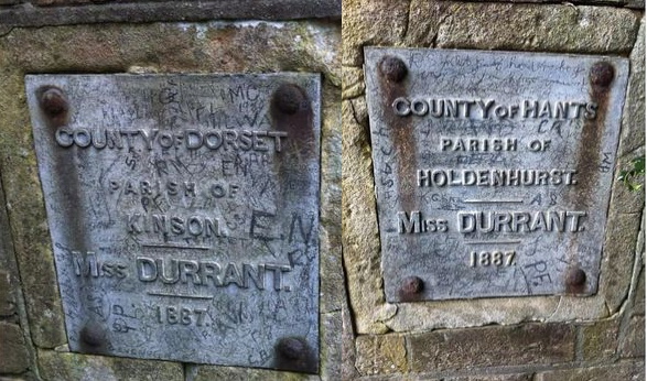
between Hampshire and Dorset. It was erected by Elizabeth Durrant, then owner of the Branksome estate.
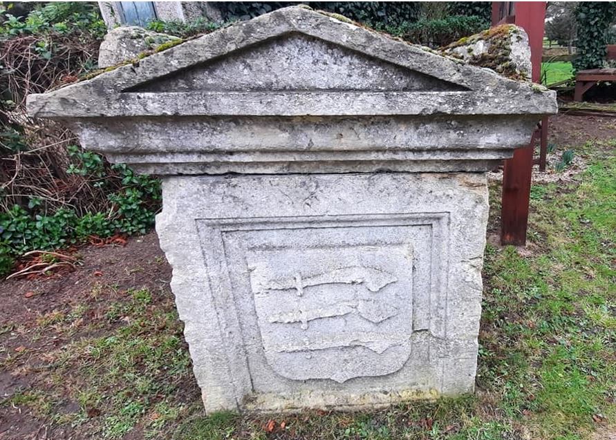
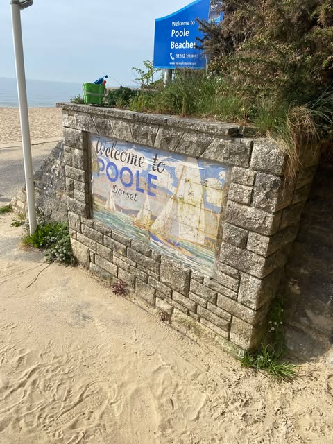
Another Hampshire-Dorset boundary marker was a stone

located just east of Bournemouth, placed there in Victorian times and indicated by BS for Boundary Stone on the ordnance survey map
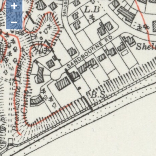
The stone was still in position in 2019 whwhen the Hampshire flag was registered, as seen next to the Dorset flag in the above picture but sadly, by 2025 the stone had been removed.
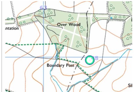
The meeting point of four counties
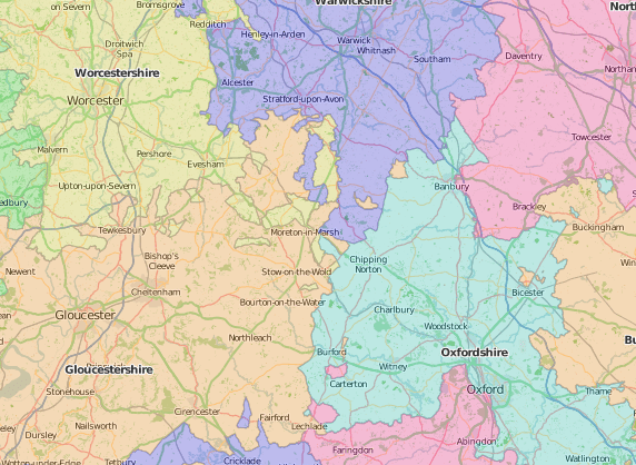
comprising territories from Gloucestershire, Oxfordshire, Warwickshire and Worcestershire
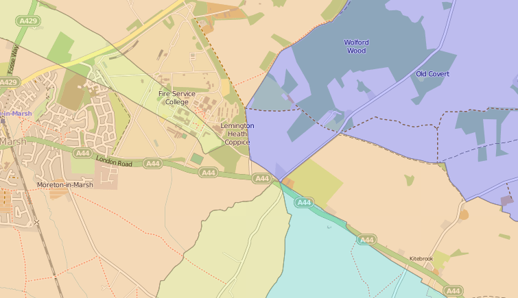
near Moreton-in-Marsh, is famously marked by “Four shire stone”

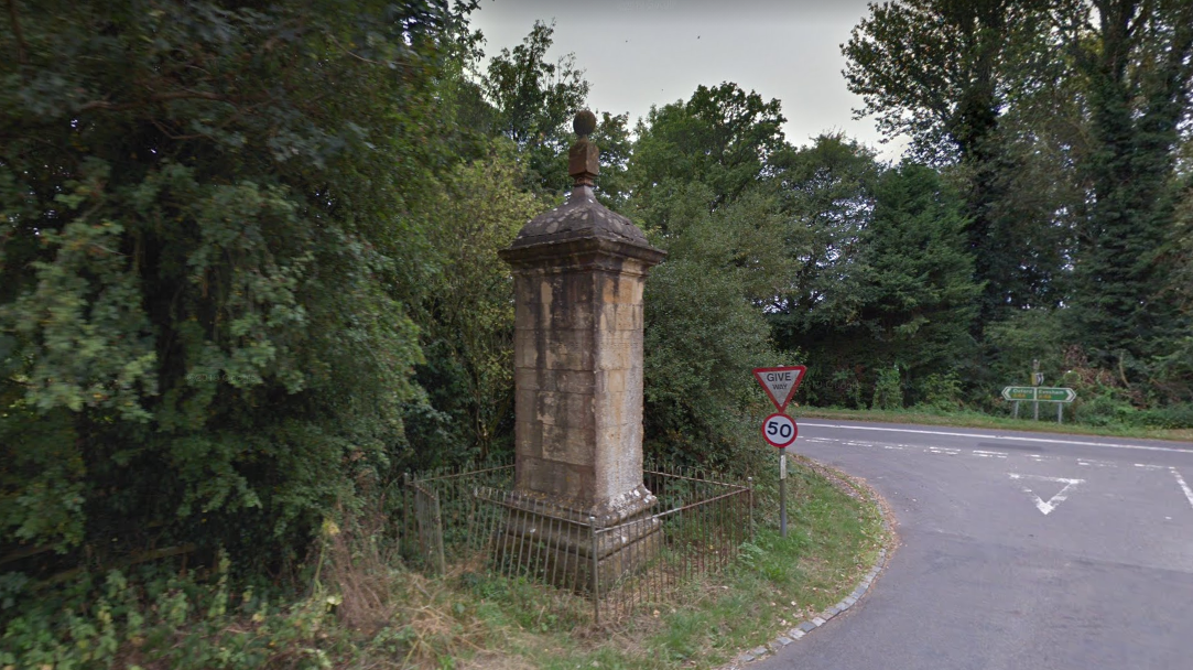
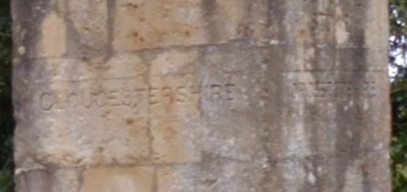
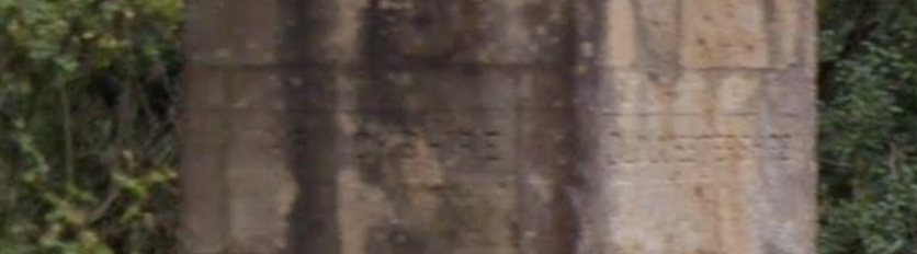
recently renovated
 The meeting point is formed by small exclaves or “detached parts” of Worcestershire and Gloucestershire, juxtaposed between Oxfordshire and Warwickshire
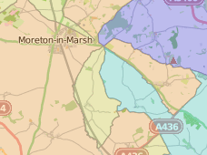 and was erected in the 18th century, replacing an earlier similar marker, before most such county outliers were removed for administrative purposes, by the “Counties (Detached Parts) Act 1844”.
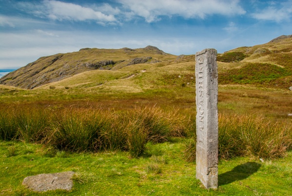
A less orthodox “sign” marks the spot
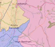
where Yorkshire, Westmorland and Lancashire meet,

“The County Stone” is a large boulder, which has designated the point were the three counties join, for a nearly a thousand years. This view is looking west and south from Yorkshire into Lancashire, with Westmorland to the right.
Further west, the location where Westmorland and Lancashire join Cumberland

is highlighted by the Three Shire Stone at Wrynose Pass
first erected in 1860 and restored in 1998.
And in the Trough of Bowland is the “Grey Stone of Trough”
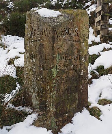
marking the boundary between between the West Riding of Yorkshire and the County Palatine of Lancashire.
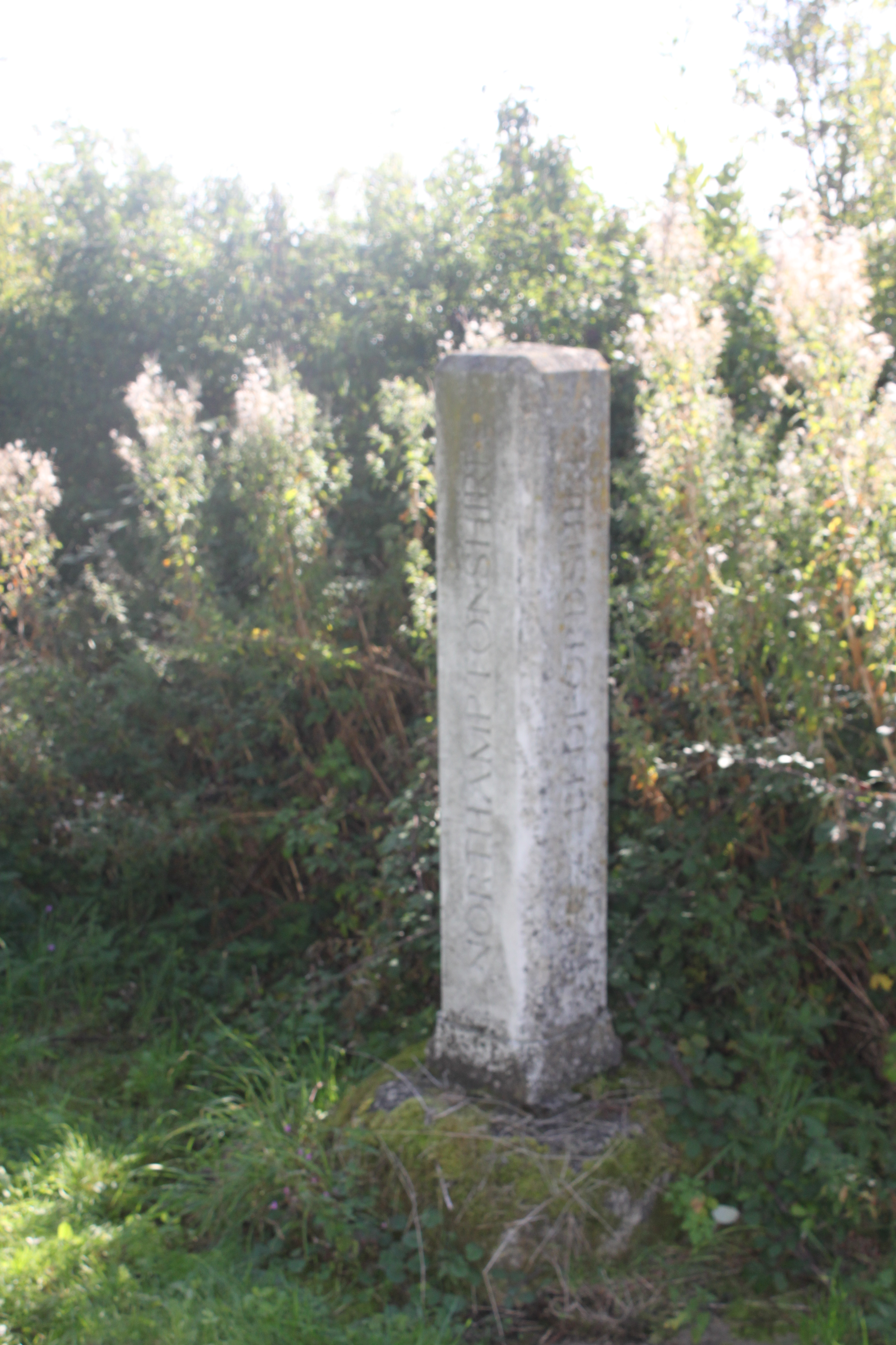
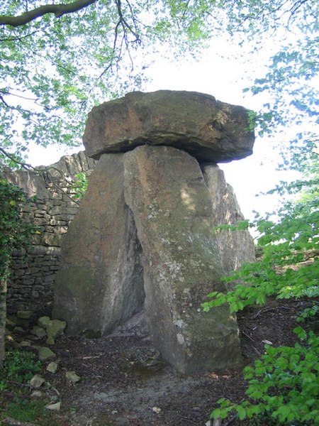
A similar structure
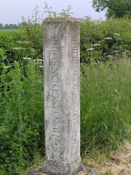
is found on the south side of the B645, where Northamptonshire, Bedfordshire and Huntingdonshire converge.
The River Tyne forms the boundary between Northumberland and County Durham; satisfyingly, this boundary is marked on the wall of the tunnel which runs under the river, linking the two counties
 Another boundary marker appears on a cottage wall


located at a point between the villages of Cawsand in Cornwall and Kingsand in Devon.


The Devon village lies in one of two detached parts of the county, that are located on the western bank of the Tamar, so the sign predates the 1844 act that removed these for purposes of administration.
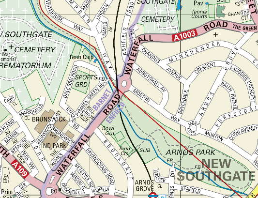
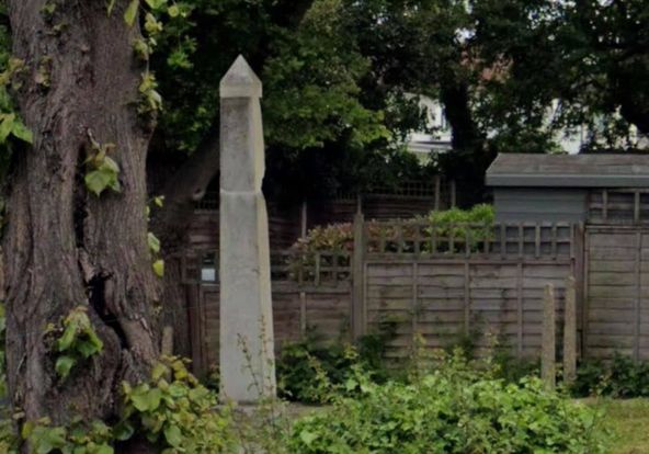
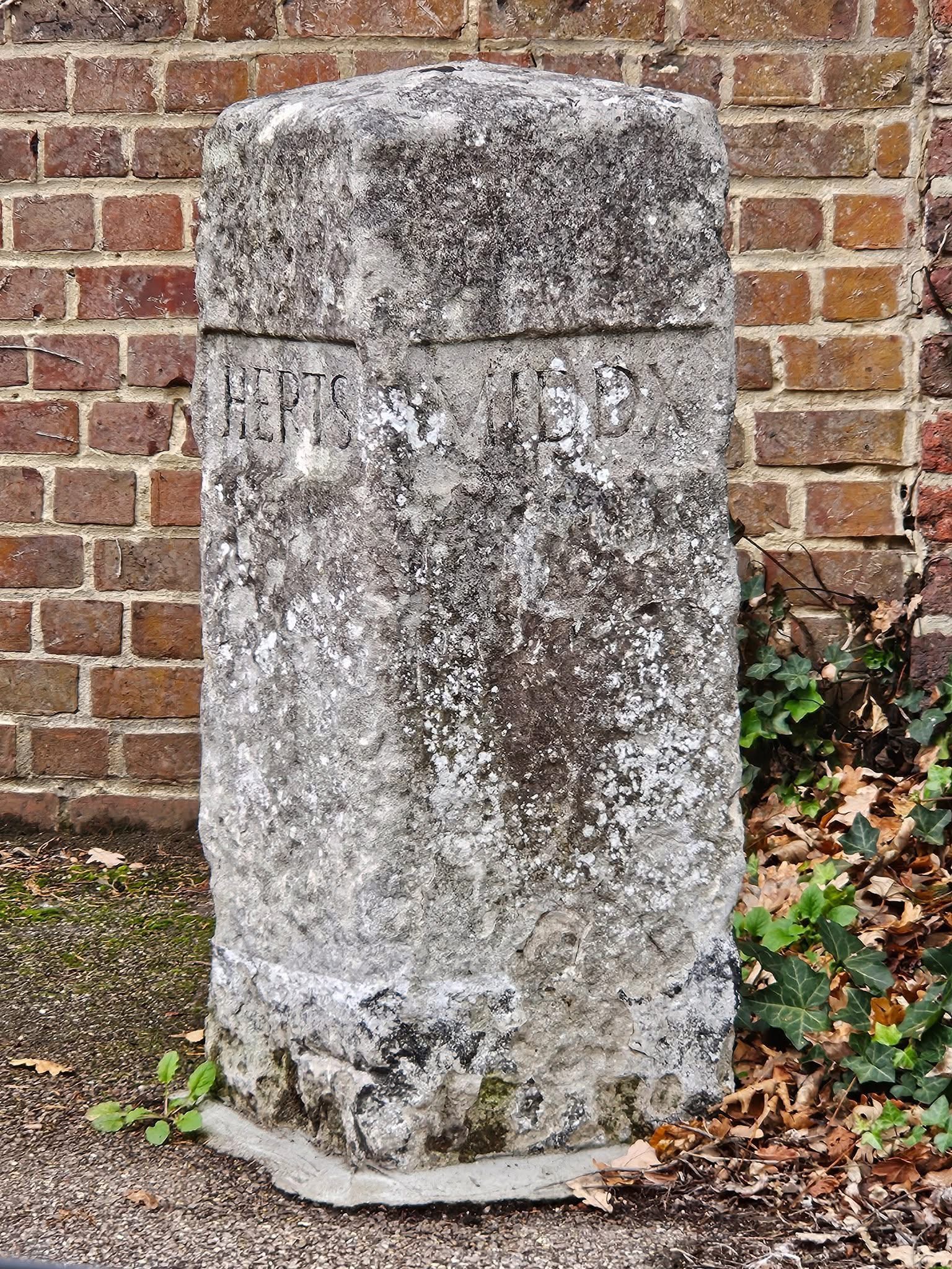
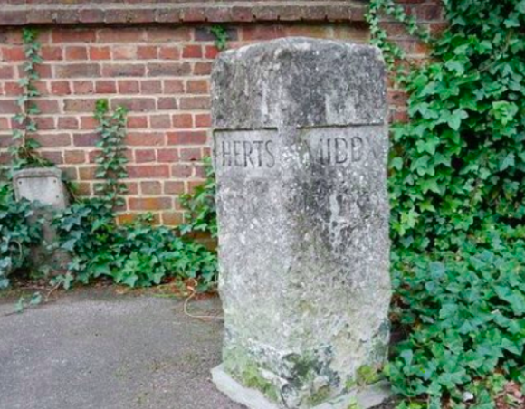
The boundary between Middlesex and Hertfordshire, on the Western edge of the Metropolitan district of Southgate
is indicated by an 18th century obelisk
Carelessly damaged by workmen and left in ruins, with pieces strewn across a grass verge for years,
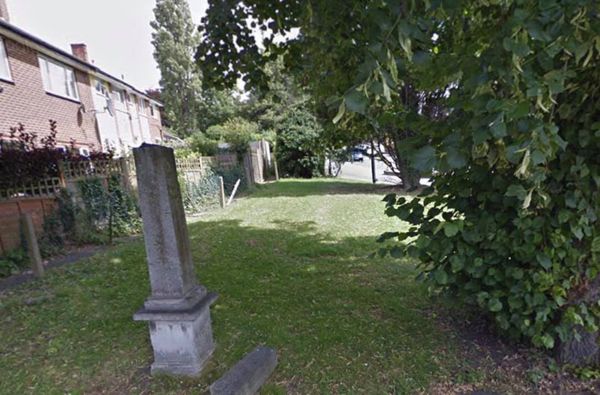
the marker was restored by local conservation group Southgate Green Association and is located on Waterfall Road
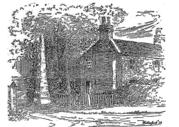
A sketch of the obelisk appeared in a local newspaper article published in 1935.
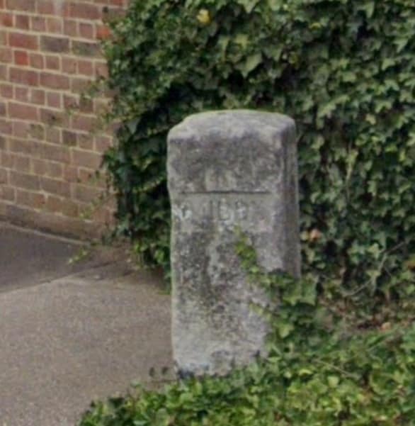
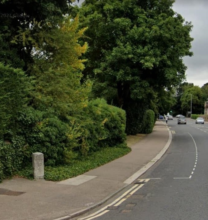
Another Hertfordshire-Middlesex boundary stone can be found on the High Road in Bushey Heath, also identified as the highest point in Middlesex at 505 feet.
A further, rather grand, boundary post between Middlesex and Hertfordshire,

that once stood on the railway bank south of Hawkshead bridge, Potter’s Bar.
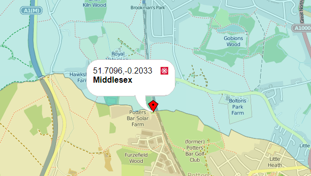
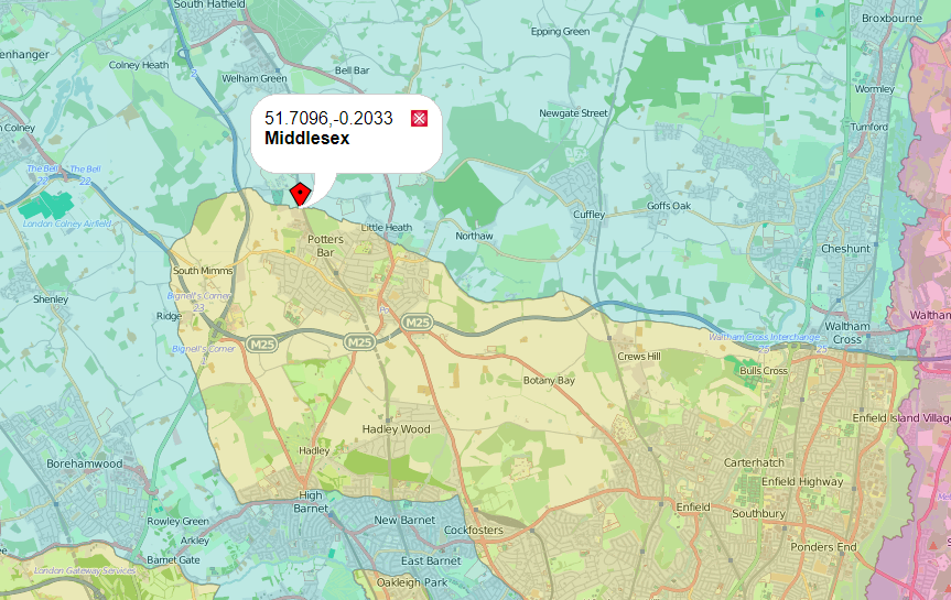
was erected by London North East Railways in 1934-5, but the names were removed in 1940 as part of the effort to thwart potential German invasion.
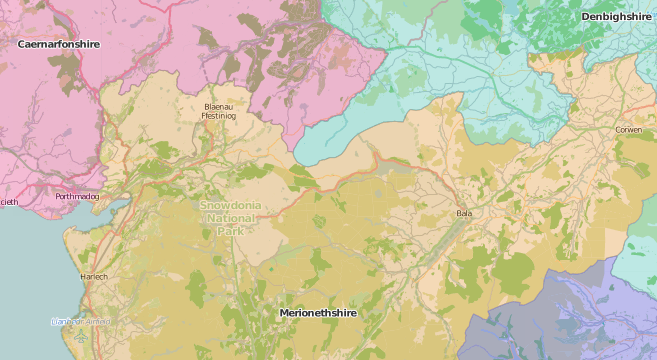
The Caernarfonshire, Merionethshire and Denbighshire Three shire stone

The Gloucestershire, Somerset and Wiltshire, Three Shire Stone

Three Shire Heads Bridge and waterfall, at the junction of Cheshire, Derbyshire and Staffordshire
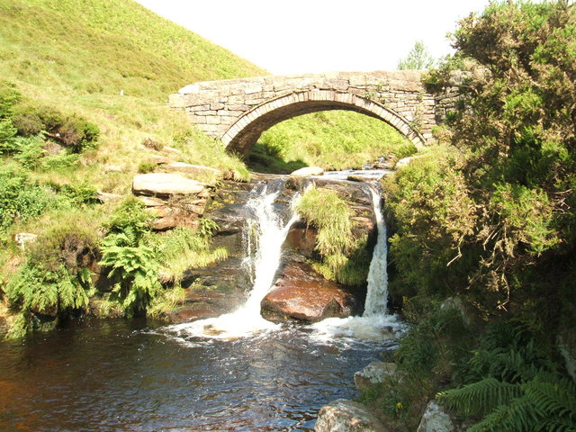
located on Axe Edge Moor
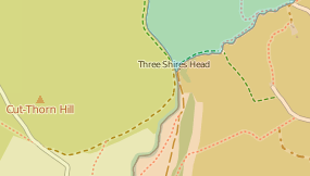 on the River Dane.
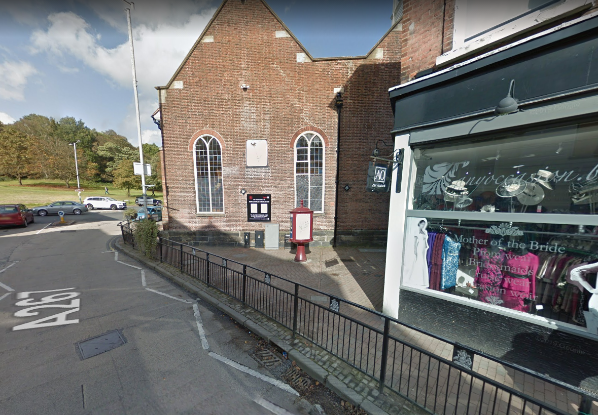
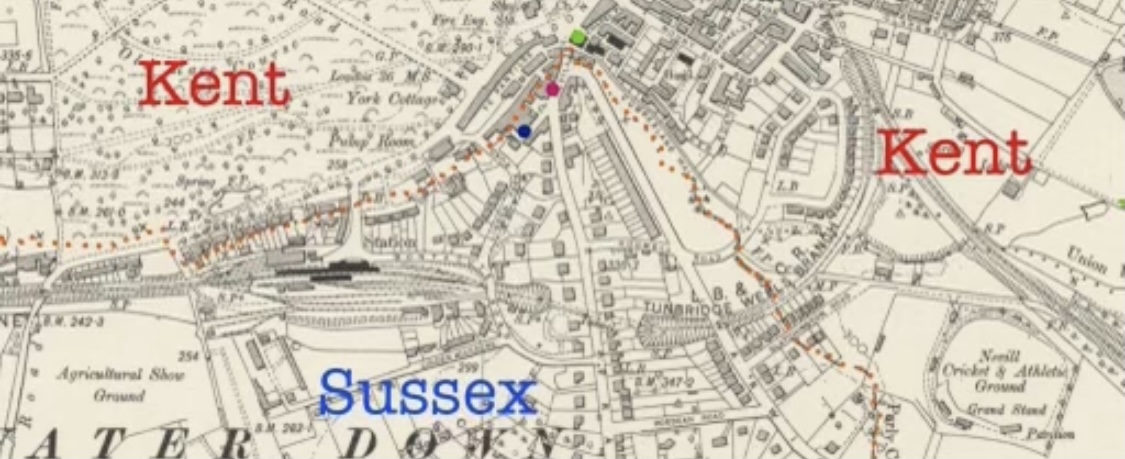
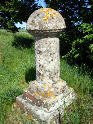
The town of Tunbridge Wells straddles the boundary between Kent and Sussex
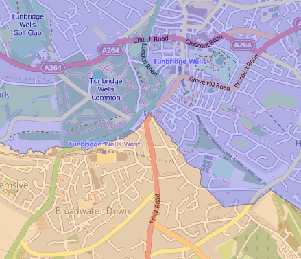 and is marked in the town by this boundary stone
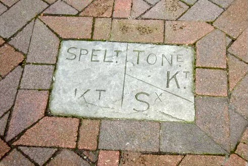
located in Nevill Street
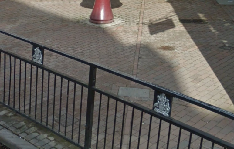
just by the King Charles The Martyr Church (south-west)
 In this 1719 view of the Pantiles, in the town,
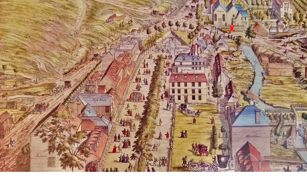 looking west, the Grom Brook county boundary is seen and the above stone is located, where the red X is shown, at the point that the brook turns south. The ancient Grom Brook boundary, now underground, flows west up to the point by the church where it makes a sharp southerly turn. On the map below from 1910, the county boundary is picked out in orange dots.
 Thanks to Sussex Flag for these illustrations and details.
The Sussex Arms public house in The Pantiles
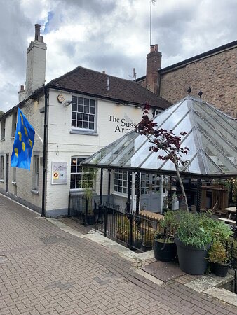
, near the northern end of Frant Road, in the town
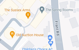 is located on the Sussex side of the county boundary which bisects the town.
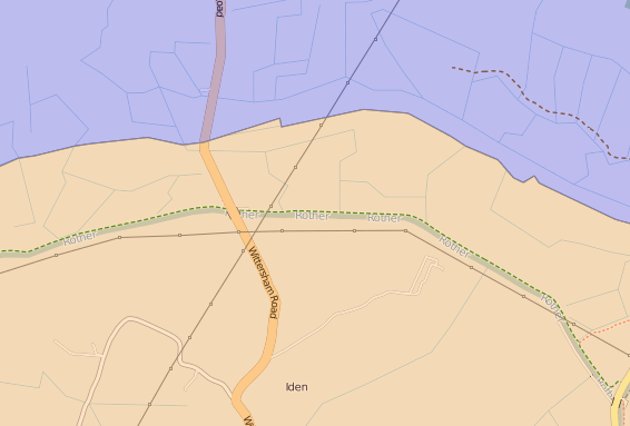
A further Sussex and Kent boundary marker
is located further south, near Iden in Sussex.
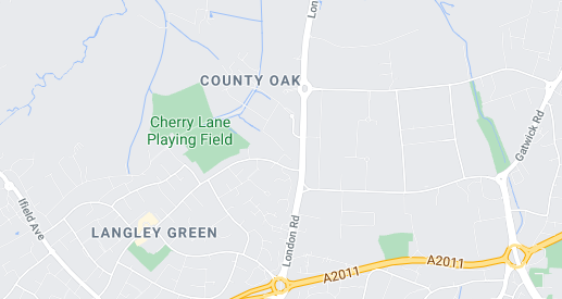
 For centuries a Sussex boundary marker, with Surrey, was a famed oak tree. The County Oak sat at the west side of the London Road, now the A23, in the town of Langley Green
Sadly the oak was cut down in 1844, in what appears to have been a barbarous act of self-interest, to judge from this 1884 letter published in “The Monthly Packet” in 1884
 the “vestry screen” or wooden plaque,
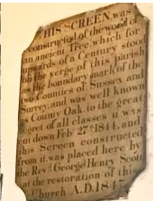
fashioned from the tree, mentioned in the above letter, can still be seen at Ifield Church, a short distance to the west
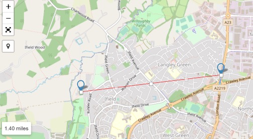
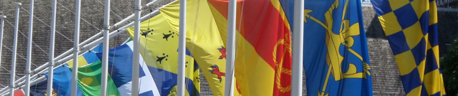
The spot today is covered by a bus stop, seen below, appropriately decorated with the county flags of Surrey and Sussex on either side of the boundary straddled by the stop.

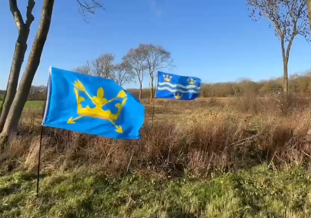
An unremarkable and unmarked, stone, which itself marks the boundary between Suffolk and Cambridgeshire
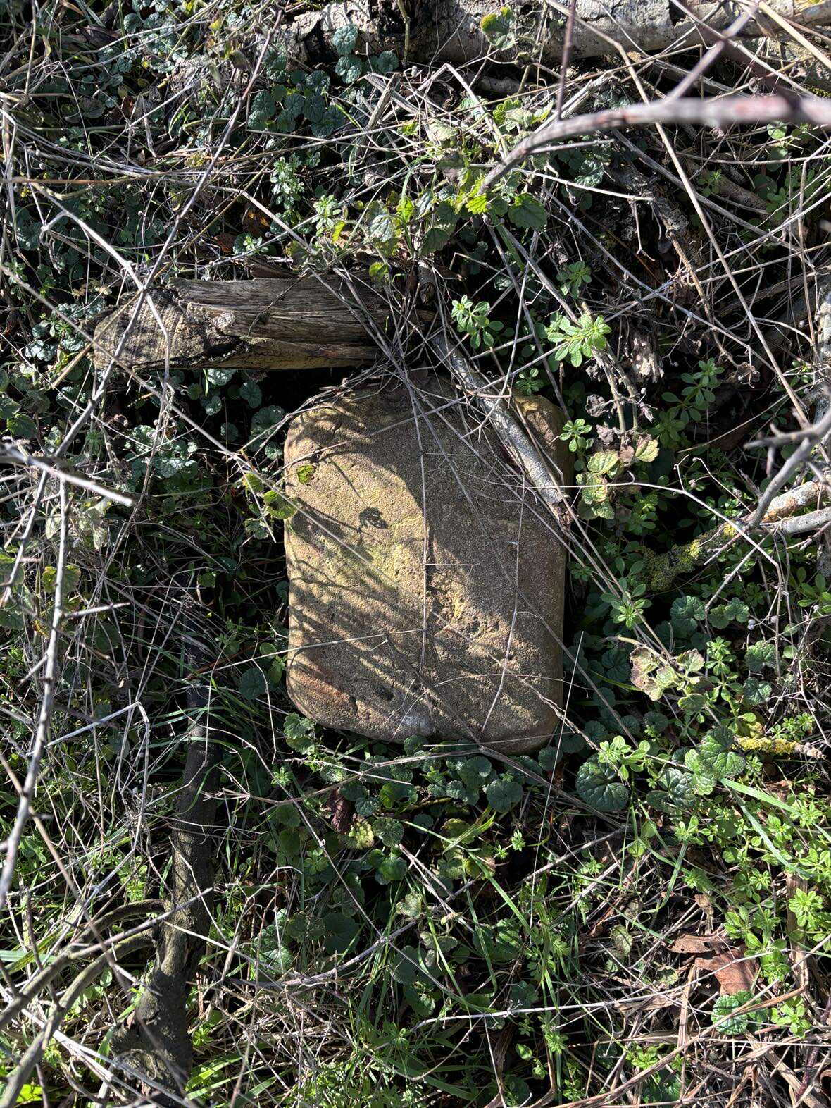
as indicated on the Ordnance Survey map with the term “Boundary Post”,
with the respective county flags flying on either side.
On the front of a house in Bridlington, is a sign indicating its location within the East Riding of Yorkshire.
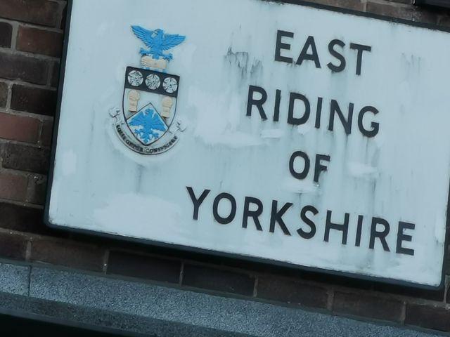
Photo from Andrew Clark.
A list of county tripoints can be found here.

